CHICAGO: BRONZEVILLE
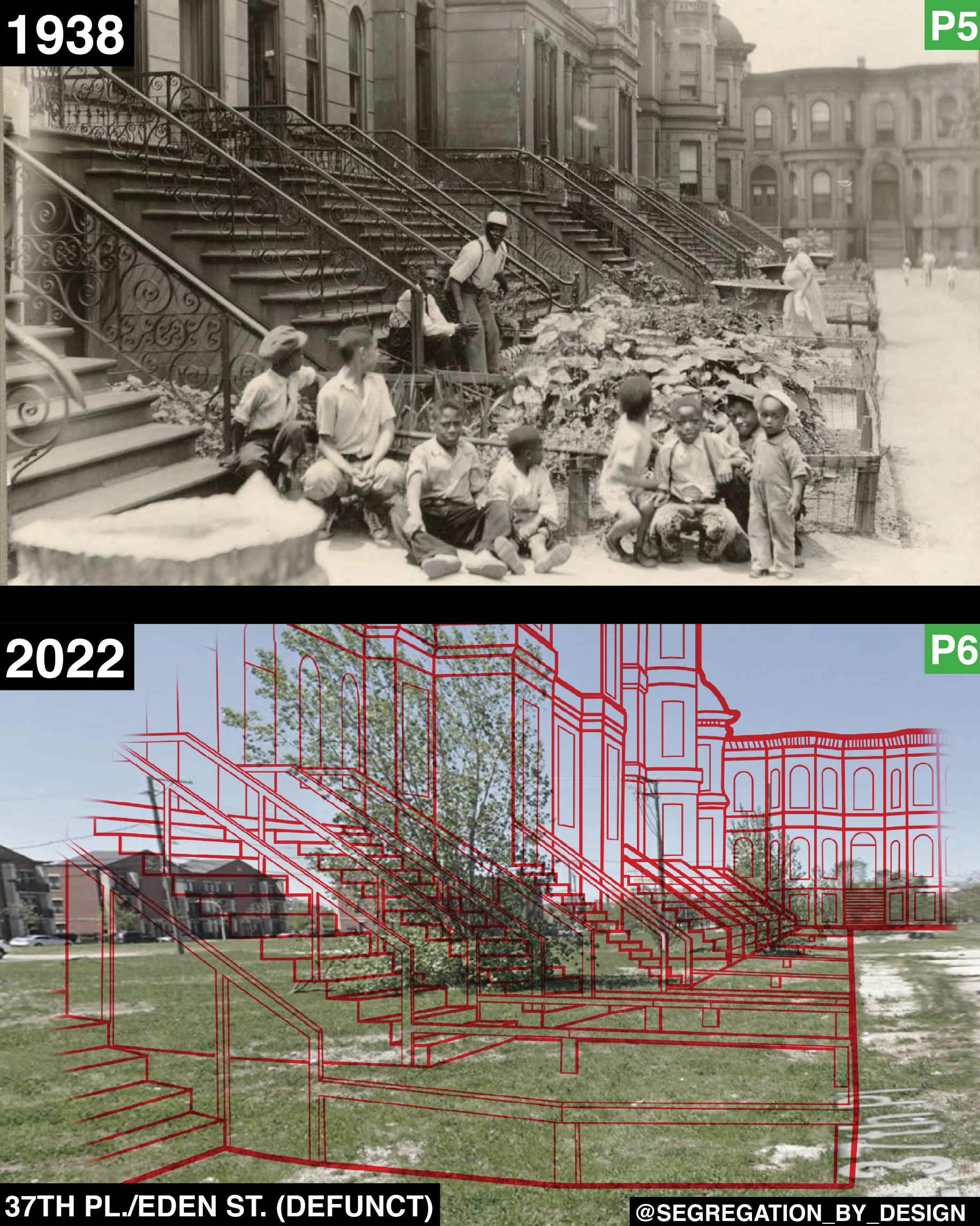
Aldine Square on the South Side of Chicago, before and after government-led “urban renewal.” In 1939 the Chicago Housing Authority destroyed this block and dozens of surrounding ones, which were in the northern portion of Bronzeville, a large neighborhood known as “The Black Metropolis,” due its large Black middle class, many Black-owned businesses (including the first Black-owned theater in the US), and more.
[Note: I was unable to find an aerial image of this portion of Bronzeville before it was destroyed, so in the second image I’ve overlaid the Sanborn Maps from the 20s, which show the neighborhood as it was before “urban renewal.”]
Just a few years before, Bronzeville had been “redlined.” Redlining was a policy in which the federal govt went city-by-city, neighborhood-by-neighborhood grading neighborhoods for investment-worthiness—based on race. Areas with large populations of color were deemed “hazardous for investment,” beginning an intentional feedback loop of decay in which property values plummet, tax bases dry up, municipal services are scaled back, and physical decay begins.
Despite these forces, the gov’t comments concerning Bronzeville describe the repair of the buildings as “good,” the sales demand as “up,” and that in general, “transportation is good and all conveniences are available.” However, the document notes that because “this area has virtually 100% negro occupancy and includes the largest negro conencentration in Chicago,” that it was hazardous for investment. The redlining documents go on to warn that “a continued influx of negroes will cause an overflow into adjoining sections, and although efforts are being made to restrict their encroachment into more desirable areas, sales demand from white persons in these adjoining areas is lessening.” (source @urichmond)
In an effort to stem this “encroachment,” the Chicago Housing Authority (CHA) seized huge swaths of Bronzeville through eminent domain and razed them, to be replaced with massive new public housing projects. In doing so the CHA displaced 5,239 families (over 18,000 individuals). 5,177 of the families displaced were Black, while just 62 were white.

The govt offered well below market rate to building- and home-owners (and, indeed, the redlining map notes that 50% of the residences are “owner occupied,” making it one of the highest proportions of Black ownership in the country at the time), and nothing to those who rented. (source @urichmond)
Many of those displaced ended up in the newly built CHA housing projects, having been robbed of their generational wealth when their family homes and businesses were destroyed. The projects the government built were notoriously poor quality, having been built by the lowest bidder as CHA stipulated. Many of these projects were eventually demolished, but in the fourth image you can see one of the “townhomes” which occupied this site until it was demolished in 2009. This CHA project, the Ida P. Wells Homes, was split between townhomes of this style, and high-rise apartment blocks. (In fact this entire housing project is visible on Google street view if you use historic imagery.)


In his book “Making the Second Ghetto: Race and Housing in Chicago,” Prof. Arnold Hirsch described the Bronzeville projects as “a cluster of high-rise buildings that housed 27,000 and came to symbolize the way postwar public housing nationwide concentrated Black poverty and exacerbated segregation.” Just west of these new projects was the Dan Ryan Expressway, completed at the same time, which “was symbolic of the way that highways nationwide were constructed to connect suburban white commuters to downtown business districts, gutting “Black Belts,” and literally dividing communities with concrete.”
More on the South Side and Bronzeville to come.